How distances really work in the mountains, what transport options you will find, what to ask before you pay and how to travel leaving the smallest possible mark.
This guide carries no timetables, fares or company names, and that is deliberate: they are the details that change most often and the ones we can least guarantee. What we can give you is what does not change — how the territory behaves, which options exist and what to ask before paying — so that you confirm the rest with whoever is actually accountable for it.
Distances are not measured in kilometres
Quindío is small and most of its towns are less than an hour apart, but here it is the road that sets the time, not the map. These are mountain roads, with bends, roadworks and slow overtaking behind a lorry. Add that in high season and during festivals the traffic concentrates on a few approaches.
The practical consequence: build in margin, group your stops by proximity instead of jumping from one end of the department to the other, and do not chain two distant towns in a single day if you also want to walk in one of them.
The options you will find
- Intercity public transport. It is the usual way to move between towns, and the Terminal de Transportes in Armenia concentrates much of that network. Frequencies vary by day and season: confirm them at the terminal or with the operator on the day.
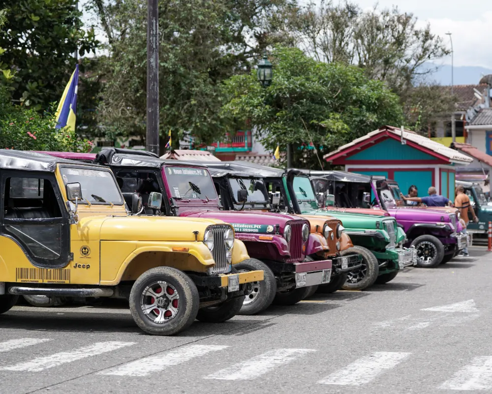
- The Willys jeeps. In Salento they are real transport towards the Cocora Valley and the outlying hamlets, as well as a symbol of the department. They leave from the main square and their rhythm follows demand; ask there about the last return, which is the detail most people overlook.
- Taxis and apps. They work well in Armenia and the larger towns; in small villages and at night availability drops. If you are coming back late from somewhere remote, agree the return before you go.
- Rental car. It gives you freedom for farms and viewpoints off the main route, in exchange for mountain driving and for parking in narrow historic centres. Requirements, insurance and conditions are set by each company: ask for them in writing.
- Private transfers and operators. Comfortable when the group is large or the destination sits away from public transport. Apply the checklist below before committing.
What to ask before you pay
This works for a transfer, a tour, a horse ride or a rental:
- Who operates the service, and what is the name of the company or person responsible?
- What exactly is included, and what is not? Entry fees, guide, insurance, fuel, waiting time?
- How long does it really take, travel included, and what time am I back?
- What happens if the weather turns, or the place is closed that day? Is it rescheduled, refunded, swapped?
- How do I pay, and what receipt do I get?
- If it is an adventure activity or transport: which permits and insurance are current?
Always ask for written confirmation — a message is enough. It is not distrust: it is what prevents misunderstandings when the plan changes.
Where the rules are published
Driving conditions, required documents, traffic rules and road status are set by the competent authorities, and they change. Check them at their official sources before you travel. We do not reproduce them here: publishing that kind of detail and letting it go stale is worse than not publishing it at all.
Travelling with the smallest mark
- Leave the money where you are. Eating, sleeping and shopping in the same town you are visiting is the most direct way for tourism to reach the people who live there.
- Share the vehicle and group the day. Fewer journeys means less noise, fewer emissions and, almost always, a better trip.
- Travel midweek if you can. It spreads the load on the busiest places, and you enjoy them more.
- Go easy on water and power at farms and rural lodgings. In the countryside neither is infinite or cheap.
- Do not buy wildlife, plants or archaeological pieces. Not as a souvenir, and not "because it was already dead".
- Take your waste with you. On the trail and on the road, what comes in with you goes out with you.
How the app helps
- The map in Explore is there to group by proximity before you commit to a day: seeing what sits near what is what saves the pointless kilometres.
- My trip builds your private plan of up to five stops, reorders it and opens it in Maps as you leave. The distances it shows are indicative, and the navigation is done by Maps, not by the app.
- The editorial routes already come ordered by the team, so they solve much of the routing problem for you.